Showing posts with label Weather 天气. Show all posts

Monday, December 16, 2019

恶劣天气预警!彭柔森甲大雨至周二

恶劣天气预警!彭柔森甲大雨至周二


大马气象局今天发出恶劣天气预警,彭亨、柔佛森美兰和马六甲数个地区预计大雨会持续至下周二。

气象局总监再兰西蒙周日发文告说,受影响地区是彭亨云冰,以及柔佛昔加末、居銮、丰盛港、古来和哥打丁宜。

此外,他说,气象局也发出大雨警报,涉及地区有彭亨马兰、关丹、百乐、北根;柔佛东甲、麻坡、峇株巴辖、笨珍和新山。

他说,该局也向森州瓜拉庇劳、林茂、仁保和淡杯,以及整个马六甲发出大雨警报。

~光华日报~

Friday, November 29, 2019

Kuantan river reaches dangerous level

Kuantan river reaches dangerous level; flooding hits Setiu


As of 11pm, the river is at 36.9m – almost a metre above its dangerous level. NSTP/Courtesy NSTP reader

State Disaster Management Agencies are on high alert after Sungai Lembing breached its ‘dangerous’ level on Thursday night.

As of 11pm, the river is at 36.9m – almost a metre above its dangerous level.

According to Kuantan police chief Assistant Commissioner Mohamad Noor Yusof Ali, who is also disaster operations commander for Kuantan, the river’s water level rose as a result of a continuous downpour since Thursday evening.

"If the thunderstorm in the area continues, the chances of flash floods occurring are very high.

"The (rising water level) could also affect Panching and Kuantan town, as it coincides with the high tide" he said.

Mohamad Noor said all agencies are surveying their respective sectors and making preparations to carry out rescue operations in the event of flooding.

Meanwhile, several areas in Setiu, Terengganu, were inundated by floodwaters at 10pm on Thursday night.

According to the state Disaster Management Agency, floodwaters near Jalan Kampung Bukit/Alur Lik are up to 0.6m deep.

Roads in the area are now closed to all light vehicles and motorists are urged to use alternative routes to travel to and from Kampung Tayor and Kampung Bukit.

~New Straits Times~

Tuesday, November 26, 2019

Red flag warning at all Pahang beaches, lifeguards on standby

Red flag warning at all Pahang beaches, lifeguards on standby


Red flags have been raised at all popular beaches in the state to warn beach-goers about potential strong waves during the monsoon season. - NSTP/FARIZUL HAFIZ AWANG

Pantai Teluk Chempedak, Sepat, Batu Hitam and Balok are now closed to swimmers and all water activities are prohibited due the possibility of unusual high-tide phenomenon.

State Civil Defence Force (APM) director Zainal Yusoff said the popular beaches here have been declared unsafe for swimming activities and people should stay away from entering the water.

He said lifeguards from APM were stationed during weekends and school holidays at the major beaches here between 9am and 7pm to warn beach-goers and attend to any emergencies at the beach.

“Six lifeguards will be stationed at designated beaches to monitor from the watch towers, and patrol the beach stretch on foot and motorcycles.

“Each team is equipped with jet skis, boats and our lifeguards are skilled in first aid and CPR (cardio pulmonary resuscitation).

“There is an increase of visitors at the beach due to the school holidays. We advise the public to cooperate and listen to instructions from the lifeguards,” he said today.

Zainal agreed that despite the red flags, people were not paying attention and some continue to enter the water with their children.

“They give various reasons including the weather is hot and there is no signs of rough seas, or insisted they are good swimmers.

“Our lifeguards do their best to remind the public about the danger posed by the waves and try to ensure the public do not take any risks," he said.

Meanwhile, Zainal said heavy rain in Kuantan, Pekan and Rompin over the past two days did not affect water levels at major rivers in Pahang.

On a separate note, State Secretary Datuk Seri Sallehuddin Ishak said all outdoor recreational activities in Pahang have been suspended between Nov 20 and Jan 20 next year, or a date to be announced later.

~New Straits Times~

Monday, November 25, 2019

Yellow weather alert in east coast from tomorrow

Yellow weather alert in east coast from tomorrow


The Malaysian Meteorological Department has issued a yellow weather alert in almost all areas throughout Kelantan and Terengganu, as well as several districts in Pahang following the east wind surge expected in the region from Nov 25 (tomorrow) which can bring continuous heavy rainfall.

Its director-general Jailan Simon said the areas involved in Pahang were Jerantut, Maran, Kuantan, Pekan and Rompin.

“Strong winds with speeds of 40 to 50 km/h with waves as high as 3.5 metres are expected to occur in waters off the respective states, and the weather warning is effective from Nov 25 to 27 (Wed).

"In addition, the seawater level is also expected to rise due to the high tide during the period.

"The incident could pose a risk of seawater overflowing along the coast and into river mouths in these areas," he said in a statement today.

Meanwhile, he said, as the weather on the east coast was expected to improve, the orange weather alert issued on 2 pm on Nov 22 for Terengganu (Kemaman district) and Pahang (Kuantan, Pekan and Rompin) had been downgraded to a yellow alert, while in Johor the warning had been lifted.

-- BERNAMA

Monday, August 19, 2019

Air quality worsens slightly in the country

Air quality worsens slightly in the country

The air quality in Peninsular Malaysia has worsened slightly with Rompin in Pahang Air Pollutant Index (API) readings jumping from “unhealthy” to “very unhealthy” zone.

According to Department of Environment (DOE) data, the API recorded in Rompin was at 223 as at 4pm, yesterday.

On Saturday, Rompin’s API was “unhealthy” at 125.

Conditions in Kuala Lumpur remained at moderate levels during the weekend, with the API at between 65 and 67.

In Selangor, Johan Setia saw a slight increase in the API readings.

The reading recorded was at 95 compared to 92 on Saturday.

Other areas in Selangor such as in Banting (82), Petaling Jaya (81), and Shah Alam (83) maintained its “moderate” readings.

The API readings in Kedah and Perlis also worsened from “good” to “moderate”, while Sabah maintained its “good” API readings.

Other places nationwide such as in Negri Sembilan, Johor, Perak, Penang, Kelantan and Terengganu recorded “moderate” API levels.

Meanwhile, in Sarawak, Sri Aman posted an API reading of 252 and generally the haze situation here and in Miri is still bad.

The API reading worsened compared to Saturday which was at 247.

The air quality in SK Kuala Baram 2 station and the Miri Industrial Training Institute station both improved.

SK Kuala Baram 2 station recorded an API reading of 80 from 119, while the Miri Industrial Training Institute station recorded a reading of 161 from 222.

As of yesterday morning, the DOE recorded one “hot spot” (forest fire) in Sarawak

An API reading of between 0 and 50 is good, while 51 to 100 is moderate, 01 to 200 is unhealthy, 201 to 300 very unhealthy, and 301 and above is deemed hazardous.

The public can also refer to the Department of Environment (DoE) website at or by downloading the MyIPU smartphone app on ‘Google Play’ to get hourly API readings

According to the Asean Specialised Meterological Centre (ASMC) weather and haze outlook posted on Saturday at 6.25pm, it noted that hotspot activities in Sumatra and Kalimantan are likely to persist in the country.

ASMC’s satellite monitoring system has also indicated in recent times that open burning is also coming from that direction.

~News courtesy of The Star~

Thursday, August 8, 2019

Hot and dry weather in M'sia until October

Hot and dry weather in M'sia until October, says the weatherman

KUALA LUMPUR (Bernama): Malaysia is expected to experience hot and dry weather with less rainfall until October, says Deputy Energy, Science, Technology, Environment and Climate Change Minister Isnaraissah Munirah Majilis.

She said apart from Malaysia, neighbouring countries Singapore and Sumatra in Indonesia are expected to experience the same weather pattern.

"We expect to experience a shortage of rainfall with warmer and drier weather this year without the El Nino and La Nina phenomena until October, " she said when asked about the essence of the 21st Technical Working Group (TWG) Meeting and the Ministerial Steering Committee Sub-Region on Cross-border Haze Pollution in Brunei.

She said this when contacted on the Bernama News Channel (BNC) talk showroom programme here Wednesday (Aug 7) night.

Commenting on the meeting, Isnaraissah said the five countries involved had presented measures taken to address fires and haze in their respective countries.

"Among the information shared was to carry out continuous monitoring of weather and hotspots, enforce the law and have the equipment prepared, mobilise human resources and co-ordinate fire-fighting, " she said.

The annual meeting involving four other Asean countries, Brunei, Indonesia, Singapore and Thailand, was held to monitor and detail the steps taken in addressing cross-border haze.

The initiative to address the Asean haze problem began following a serious episode of pollution in 1997 that led to the Asean Convention on cross-border haze signed by 10 countries in Kuala Lumpur on June 10, 2002. - Bernama

Tuesday, August 6, 2019

Haze situation under control despite dry spell

Haze situation under control despite dry spell

The haze situation appears to be under control despite the dry spell as the Air Pollutant Index (API) has not reached unhealthy levels in any parts of Malaysia.

In fact, good air quality was recorded in Kota Tinggi, Johor (API reading 50), Tawau, Sabah (46) and Limbang, Sarawak (47) at 6pm yesterday.

Air quality in other parts of Malaysia was at a moderate level. 

An API reading of between 0 and 50 is good while 51 to 100 is moderate, 101 to 200 is unhealthy, 201 to 300 very unhealthy, and 301 and above deemed hazardous.

National Weather and Geophysics Operations Centre director Mohd Hisham Mohd Anip said the air quality would return to normal soon as Indonesia had succeeded in its aggressive initiative to douse the raging forest fires.

He also noted that the two low-pressure cyclones in the West Pacific and the northern part of South China Sea would further suck the atmospheric moisture.

Several west coast states in the peninsula and Sarawak are also facing the haze following forest fires at six districts in Indonesia over the last four days.

The Asean Specialised Meteorological Centre (ASMC) warned that more hotspots could be expected in the first two weeks of August, particularly in the fire-prone provinces in Sumatra and Kalimantan in Indonesia, following warmer and drier than average conditions forecast over the southern Asean region.

In the northern Asean region, hotspot activities are expected to remain subdued due to prevailing rainy conditions, according to ASMC.

~News courtesy of The Star~

Thursday, February 14, 2019

Hot and dry days to last until April

Hot and dry days to last until April

It is searing hot and dry, with five areas in the country already placed on heatwave alert.

And there’s more “hot” news – Malaysians have to put up with this weather until April, at least.

The tail-end of the north-east monsoon next month will see less rain in most parts of the country.

The Malaysian Meteorological Department (MetMalaysia), in a report on the country’s weather outlook from February to July, stated that most international climate models predicted a 65% possibility of the El Nino weather phenomenon occurring until May.

In the peninsula, Sik (Kedah), north Seberang Perai (Penang), Kinta and Kuala Kangsar (Perak) and Alor Gajah (Melaka) recorded temperatures of between 35°C and 37°C for three days in a row.

Throughout this month, the Department of Environment said most areas in the peninsula were likely to experience dry weather with less than 150mm rainfall.

It said Selangor, Kuala Lumpur, Putrajaya, Negri Sembilan, Melaka, Johor, Perlis, south Terengganu and Pahang will get slightly less average rainfall compared with the long-term average figure.

Kuching and Samarahan in Sara­wak are expected to get more rain than average, while Miri is likely to be drier.

In Sabah, most parts of the state are forecast to receive less than average rainfall.

One level up from Category 1 (heatwave alert) is Category 2, which is when temperatures rise above 37°C for three consecutive days.

When this happens, the Energy, Science, Technology, Environment and Climate Change Ministry is empowered to officially declare a heatwave in that location.

This is to enable the relevant authorities to take follow-up action such as closing schools.

When an area hits Category 3 (when the temperature hits above 40°C three days in a row, which is considered the “emergency level”), the National Disaster Management Agency will be notified and the Prime Minister can declare an emergency.

According to the MetMalaysia report, the country’s weather until July will be influenced by three weather patterns – the north-east monsoon which ends in March, intermonsoon in April and south-west monsoon, which begins in May.

The start of the intermonsoon period is expected to see more thunderstorms in the west coast and interior of the peninsula, east coast of Sabah and central Sara­wak.

In the meantime, the Fire and Rescue Department is on alert for more forest fires following a recent incident in Baling, Kedah.

~News courtesy of The Star~

Friday, December 14, 2018

Northeasterly winds expected till Sunday

Northeasterly winds expected till Sunday

Strong north-easterly winds of between 50kph and 60kph, with waves as high as 4.5m, are expected in waters off Samui and north Condore until this Sunday.

According to the Malaysian Meteorological Department, such weather conditions are dangerous to all shipping and marine activities, including fishing and ferry services.

Meanwhile, strong north-easterly winds of between 40kph and 50kph, with waves as high as 3.5m, are expected in waters off Tioman, south Condore, north Bunguran, northwest of Reef South, Reef North, Layang-Layang and west Palawan until this Sunday.

A similar weather forecast is also expected in waters off Kelantan, Terengganu and Pahang during the same period and will also be dangerous to small boats, sea sport and recreational activities.

According to the Kota Tinggi district management secretariat, they were evacuated when Sungai Pemandi overflowed its banks and entered into houses in nearby low-lying areas since 4pm.

“A total of 556 people from 162 families were evacuated to the relief centre at Dewan Kolej Vokasional Kota Tinggi at 9.15pm, while 49 people from nine families were evacuated to the relief centre at Dewan SJKC New Kota,” it said. — Bernama

Sunday, November 11, 2018

Prepare for stormy days ahead

Prepare for stormy days ahead, says weather department

Bring out your umbrellas and rubber boots because heavy rains are expected to lash out soon, bringing with it high chances of floodings.

Malaysian Meteorological Depart­ment director-general Alui Bahari said the north-east monsoon was expected to last until March and has already brought heavy rainfall to Kelantan and Terengganu.

Rain will make its way to Pahang and Johor before shifting to Sabah and Sarawak later in the season.

“These states are expected to experience four to six heavy rainfalls as in previous years,” he said.

“If heavy rainfall, high tides and strong winds occur, it could cause rivers to overflow,” he added.

The situation could be worsened by spring tides that take place during the new and full moons.

While the east coast is typically the worst hit by floods during the rainy season, west coast residents should also be on the alert.

Last year, Penang was also hit by major floods, where the state sought help from armed forces after winds and rain lashed out, causing landslides and falling trees.

However, Alui said he did not expect such rainfall over Penang and Kedah this season.

Universiti Kebangsaan Malaysia’s Professor of Climatology and Oceanography Prof Dr Fredolin Tangang said the country was entering the monsoon period earlier compared to the average mid­-November onset date.

However, he said this was within the “natural variability” of the monsoon period, which was affected by phenomena such as El Nino.

“Sea surface temperatures in the Eastern-Central Pacific Ocean are warmer than usual, indicating the progression of a weak El Nino by year end or early next year,” he said.

Due to this, he said, there was likely to be heavier rainfall in southern Peninsular Malaysia, which includes Johor and the Klang Valley.

He added there was a low possibility of extreme rainfall, which could lead to large-scale flooding as the Kelantan and Terengganu floods in December 2014.

According to his research, three phenomena should take place for such extreme weather to occur.

Firstly, he said there should be cold surges from the north and secondly, the Borneo vortex, a wind circulation system should be located close to Peninsular Malaysia.

“The Madden-Julian Oscillation (MJO) must also be active and its low pressure-centre must be located near West Sumatra,” he said.

The MJO is a phenomenon in which a low pressure system crosses eastward from the Indian Ocean to the Pacific Ocean.

The people can monitor weather and flood situations through http://portalbencana.nadma.gov.my and www.met.gov.my or download relevant mobile applications such as myCuaca and myJPS.

~News courtesy of The Star~

Friday, October 12, 2018

东海岸柔佛将遭遇多场豪雨

东海岸柔佛将遭遇多场豪雨

随着东北季风来临,东海岸3州和柔佛将由11月初至明年3月,遭遇4至6场豪雨。

气象局总监拿督阿鲁依指出,此情况将可导致容易涨水和低洼的地区发生水灾。

“我们现在处于季风交替的时期,这现象预料将于10月尾结束,过后就会进入东北季风季节。

“预料上述季风将先于11月在吉兰丹和登嘉楼刮起,过后于12月扩大至彭亨和柔佛,1月朝沙巴和砂拉越前进。”

他今日出席2018/2019年东北季风全国气候论坛后,对记者这么说。

阿鲁依说,3个因素将导致这次的季风带来水灾,分别是持续性豪雨、大涨潮和风向。

“大涨潮现象将获严密监督,因为此现象1个月内发生两次。

“我们也担心在这次东北季风的首3个月,如果上述3个现象同时发生,确实是会发生水灾,因为河水将溢出。”

另外,他说,柔佛新山和雪兰莪部分地区昨天所发生的闪电水灾和大涨潮现象,为目前正在发生的季风交替所带来的影响,预测它将持续至下月初。

阿鲁依也呼吁公众下载MyCuaca应用程序,以掌握最新的天气,以及其他有关天灾如地震和海啸警告的资讯。

“我们希望此程序可协助公众计划他们每一次发生天灾时的行程,尤其是水灾,根据截至目前的记录,约有8万名手机用户已使用此程序。”

~光华日报~

Sunday, March 25, 2018

Get weather updates through RakanMET

Get weather updates through RakanMET


Whichever part of Malaysia you are in, the RakanMET app allows you to share information and updates on the weather.

RakanMET aims to provide fast and accurate information to the public to ensure that they are better prepared to face extreme weather conditions.

Science, Technology and Innovation Minister Datuk Seri Wilfred Madius Tangau said the app was developed by his ministry (Mosti) through the Malaysian Meteorological Department (MetMalaysia).

“Users can report weather-related incidents in their areas by uploading information onto the app.

“This is done to prevent irresponsible parties from uploading fake information on the app,” he said.

RakanMET is the second app to be developed by Mosti after myCuaca, which was launched in 2015 to provide the public with the latest weather information.

RakanMET was officially launched at the Sabah Weather and Earthquake Operations Centre on Friday, in conjunction with World Meteorological Day.

MetMalaysia director-general Alui Bahari was also present at the event to sign a memorandum of understanding with Universiti Putra Malaysia to mark their collaboration in the field of meteorological science.

~News courtesy of The Star~

Tuesday, January 16, 2018

金马仑最低温仅13度

金马仑最低温仅13度


金马仑高原本周末的最低温依然处于摄氏13-15度之间。

东北季候风再遇到上多云及频雨的气候,大马罕见出现冷天气,而金马仑高原的温度更创下新低,在晚间仅有摄氏13度。

根据大马气象局预测,金马仑高原在本周末及来临的5天内都将持续出现时雨的情况,因此将持续保持低温状况。至于平均温度,将保持在摄氏16-23度之间。另一方面,根据国际天气预测网站worldweatheronline.com的预测,周六晚上也依然有可能出现摄氏13至15度的低温,但较后该区温度将慢慢回升,到了周二将恢复到17度正常水平。

~以上新闻转自光华日报~

Navy to rescue stranded tourists on Tioman Island

Navy to rescue stranded tourists on Tioman Island


The Royal Malaysian Navy (RMN) has been deployed to rescue 93 tourists who have been stranded on Tioman Island for several days following bad weather and rough seas.

A total of 54 foreign tourists and 39 local tourists have been stranded on the island since Jan 11.

Tioman assemblyman Datuk Seri Mohd Johari Hussain said Navy ship KD Terengganu is expected to arrive on the island at 10pm Monday (Jan 15).

"Tomorrow morning (Jan 16) at 7.30am, we can start transferring people from the marina," he told The Star.

Mohd Johari also said seven locals will be allowed to board the ship as they had urgent matters to attend to on the mainland.

The monsoon season in Tioman Island starts from October to March every year.

Mohd Johari also said when the monsoon season starts, the Government constantly reminds people of the situation and the risk that they may face on the island.

"During this period, fewer tourists will visit the island due to the weather but there are those who take the risk to go to Tioman with the hope that they would be able to board the ferry when the weather improves," he said.

He said this time, ferry services remained inoperable for a longer period and as such, tourists and locals were unable to leave the island.

~News courtesy of The Star~

Saturday, January 13, 2018

Heavy rain expected to hit several states

Heavy rain expected to hit several states

Heavy rain is expected to continue in several areas in Johor, Pahang, Negri Sembilan, Melaka, Terengganu and Sarawak until today.

The Malaysian Meteoro­logical Department has issued a severe weather warning for several areas in Johor and Pahang.

“Heavy rain is expected to continue in Johor (Segamat, Kluang, Mersing, Kota Tinggi, Johor Baru and Kulai) and Pahang (Rompin, Pekan and Kuantan) today,” it said in a statement.

The department has also issued a weather warning alert for Negri Sembilan, Melaka, several areas in Johor including Tangkak, Muar, Batu Pahat and Pontian, and several areas in Pahang including Bentong, Temerloh, Maran, Bera and Jerantut.

~News courtesy of The Star~

Wednesday, November 22, 2017

气象局预测东北季风期间 东海岸砂西部高雨量

气象局预测东北季风期间 东海岸砂西部高雨量


东北季风的来临,将使马来半岛东海岸和砂拉越西部出现可引发水灾的高雨量。

气象局预测,马来半岛东海岸州属和砂拉越西部,将在本月起至明年1月的东北季风期间,出现可引发水灾的高雨量现象。

科学、工艺与革新部长拿督斯里威弗烈丹敖指出,在这期间,我国将发生4至5次的强降雨,可造成大水灾。

他说,在马来半岛吉兰丹和登嘉楼所展开的天气预测,本月和12月的雨量料达约700毫米,彭亨和柔佛东部的雨量,预测将在下月和明年1月高达400毫米。

“这个情况可导致水灾,尤其是在河谷和低洼地区。”

他今天在国会下议院回答巫统巴力士隆区国会议员拿督诺莱妮博士的提问时,这么指出。

~以上新闻转自光华日报~

Monday, November 13, 2017

Expect more rain until January, says weatherman

Expect more rain until January, says weatherman

The start of the northeast monsoon today will bring more rain to the east coast of the peninsula and parts of Sabah and Sarawak.

The wet season is expected to last until January.

MetMalaysia director-general Alui Bahari said the northeastern winds from the South China Sea will mark the start of the monsoon season.

“Right now, the winds are still from the southwest, they are variable, but by tomorrow, they will persist from the northeast,” said Alui when contacted yesterday.

He said an episode would range between three and four days of moderate to heavy rain.

This monsoon season is expected to see four to five such episodes.

MetMalaysia has its own colour coding for rainfall, with yellow indicating heavy rain is expected within the next one to three days, and if there is continuous rain, it will not last for more than six hours and the rainfall will be less than 60mm.

Meanwhile, orange indicates continuous heavy rain that will exceed six hours and rainfall collection of at least 60mm while red shows continuous heavy rain exceeding 240mm a day.

Alui said the department would also be monitoring wind speeds and wave heights, as monsoon winds could whip up waves.

For the day’s weather forecast, log on to www.met.gov.my/in/web/metmalaysia/forecasts/general/country.

~News courtesy of The Star~

Wednesday, June 21, 2017

Clear skies expected over Raya

Clear skies expected over Raya

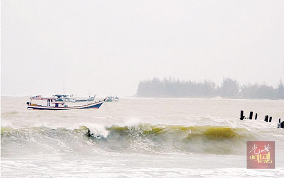
It will likely be a sunny Hari Raya Aidilfitri this year in most parts of Peninsular Malaysia and Sarawak.

The date for sighting the Syawal new moon to determine when Aidilfitri falls has been set for June 24, and many expect Hari Raya to start the next day.

Malaysian Meteorological De­­part­­ment director-general Alui Bahari said a detailed forecast for the Hari Raya Aidilfitri period will only be released today but added that the weather is generally expected to be dry due to the current south-west monsoon.

The south-west monsoon started on May 17, and will continue until September, typically associated with lower rainfall in Peninsular Malaysia and Sarawak.

“There is always heavy traffic on the highways during the Raya pe­­riod, but good weather conditions will hopefully help to make journeys safer as the roads are dry and visibility is better,” said Alui.

The volume of vehicles that will hit the roads starting this week as families make their way back to their hometowns is expected to grow.

PLUS Malaysia Bhd said traffic plying the North-South Expressway during peak days starting Wednes­day to July 3 is set to hit 1.7 million vehicles per day.

The figure is an increase of 30% from the reported 1.2 million vehicles during the Raya peak period two years ago.

Another highway concessionaire, Lingkaran Trans Kota Sdn Bhd (Litrak), expects a 10% increase in the number of vehicles on the Sprint and Lebuhraya Damansara-Puchong (LDP) highways in Selangor as the Hari Raya celebration draws closer.

The LDP, which is normally used by more than 470,000 vehicles each week, may see an increase of about 10,000 vehicles this week.

Association of Highway Con­cessionaires Malaysia said in a statement that the volume of traffic is expected to increase by between 30% and 40% during the coming Raya period compared to normal times.

“The Kuala Lumpur-Karak Express­­way, East Coast Expressway (LPT1) and East Coast Highway 2 (LPT2) is expected to see an increase of 50% in traffic volume,” the statement said.

To cope with the traffic volume, PLUS has issued a travel time advisory to help the public plan their journey and to distribute traffic between June 21 and July 3.

Those planning to travel from the Klang Valley to their hometowns in Perlis, Kedah, Penang, northern Perak and Johor are advised to enter the highway before 10am.

Those heading towards nearer destinations such as in Selangor, Negri Sembilan, Melaka, southern Perak and central Perak, are advised to start their journey and enter the North-South Expressway after 10am on designated days.

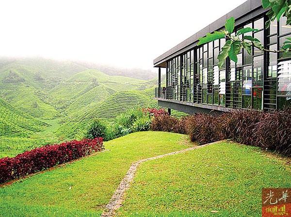
Meanwhile, Penang is expecting an influx of visitors who are set to take advantage of the four-day Aidilfitri holiday.

“Last year, the traffic was not so bad, but it is too early to predict the congestion this year,” said state traffic police enforcement chief Supt Roslan Ali.

He added that traffic police would be out daily under Ops Selamat from now until July 2.

Malaysian Hoteliers Association Penang Chapter chairman Khoo Boo Lim said most hotels in the state were almost full.

“Penang is a top choice for local tourists and many are definitely coming here during the break,” he added.

~News courtesy of The Star~

Thursday, May 18, 2017

Hot, dry days until September

Hot, dry days until September

The southwest monsoon has brought with it hotter and drier weather to peninsular Ma­­laysia and Sarawak.

Malaysian Meteorological Depart­ment (MetMalaysia) director-general Alui Bahari said the monsoon season started yesterday.

He said the southwest monsoon came after the end of the inter-monsoon period which brought heavy rains to the peninsula last month.

The monsoon is expected to last until September.

“Generally, during the southwest monsoon, the country will experience lower rainfall in the peninsula and Sarawak,” Alui said in an email.

He said there would be more dry days ahead than wet ones in these two areas during this period.

“But Sabah will receive more rain than other states” he added.

According to the MetMalaysia website, there are four seasons in Malaysia - the southwest monsoon (May to September), northeast monsoon (early November to March), and two inter-monsoon seasons in between.

Rain is only expected to return in October during the next inter-monsoon period.

The northeast monsoon will bring heavy rain to the east coast of Peninsular Malaysia, west Sarawak and the northeast of Sabah.

Meanwhile, to escape the hot weather, more people have been seeking shelter in shopping malls

Malaysia Shopping Malls Asso­ciation adviser HC Chan said families would spend more time in malls when the weather got hotter.

“They will have many options in­­clu­­ding going to the restaurants and shops to escape the heat,” he said.

Chan said since the hot spell began recently, there has been a 10% increase in the number of visitors to shopping malls in the Klang Valley.

~News courtesy of The Star~

Pahang FM radio frequencies

  Bukit Istana    88.10 MHz - Radio Klasik  89.90 MHz - TraXX FM  90.70 MHz - Ai FM  91.90 MHz - Minnal FM  92.70 MHz - Pahang FM  93.50 MHz...